The Iron Age in the Abergavenny Area: a brief overview
The Iron Age in the Abergavenny Area: a brief overview
By Gill Wakley
What strikes anyone viewing
the landscape around Abergavenny is the number of hills. If you look at the
sketch map from Gwent County History (GCH page 141) there is a lack of
hillforts close to Abergavenny and the hillforts on the map tend to overlook the
coast and river valleys which were major routes of transportation. Surprisingly
this map does not show many iron age settlements in the Abergavenny area which
is situated on the Usk between Twyn y Gaer Hillfort to the north and Coed y
Bwnydd hillfort to the south. In Wales there were over 1000 monuments that
could be termed Iron Age hillforts.
This is a map in an article by Ray Howell and Joshua Pollard, 'The Iron Age Settlement and Material Culture' in The Gwent County History, Vol. I, p.141.
This is a map in an article by Ray Howell and Joshua Pollard, 'The Iron Age Settlement and Material Culture' in The Gwent County History, Vol. I, p.141.
 |
| Fig. 6.1 Iron Age hillforts in Gwent (Tony Daly, National Museums and Galleries of Wales).Apart from Twyn y Gaer and Coed y Bwnydd the map also labels Llanmelin, Sudbrook and Lodge Wood. These are hillforts that have been excavated. |
As Ray Howell and Joshua Pollard have stated, there
has been little excavation and what has taken place targets larger sites
predominantly hillforts. (GCH. p.140.) However, the Portable Antiquities scheme
is providing evidence of finds such as horse terrets (reign guides) which
indicate the importance of the horse in Iron Age society (GCH p.142). Howell
and Pollard state that the Portable Antiquities Scheme has provided chance
finds but does not deliver the understanding gained from systematic fieldwork
and excavation.
Settlement Evidence
Hillforts are ubiquitous in
the landscape and dominate our thinking, but since the 1980’s Martin Bell has
been finding evidence on the Gwent Levels for rectangular buildings of middle
Iron Age date. (GCH p.143.) Settlements such as the small enclosed settlement
near Chepstow, Thornwell Farm, may well have been the more common type of
settlement in the Iron Age. Rachael Rogers the curator of Abergavenny Museum
has provided this Iron Age cooking pot amazingly reconstructed by a Cardiff
university student as part of her course. The discoloration around the base is
where it would have sat in the fire. It is important as it represents the
domestic Iron Age life.
Two large hill forts in the North of Monmouthshire are Coed y Bwnydd and Twyn y Gaer
Twyn y Gaer (click on Coflein and scroll down for pictures)
 |
| Copyright, Abergavenny Museum |
Two large hill forts in the North of Monmouthshire are Coed y Bwnydd and Twyn y Gaer
 |
| Taken from GCH vol 1, p.149 Fig. 6.4, 'The Iron Age: Iron Age Settlement and Material Culture'. |
Coed y Bwnydd hillfort, near Clytha
overlooks the Usk Valley and is multivallate on the east and south with a
single vallate on the steeper western side. A large outwork protects the
entrance. Four round houses were identified. There is evidence of occupation over
a long period before abandonment (Babbage 1977). Activity seems to have ceased
in the 3rd Century and its defences were slighted at the
end of the Iron Age. There was a surprising lack of finds and an absence of
metal work and stone implements. (GCH p.153) It is now noted for its
spectacular bluebells in spring but it still retains the outlines of the
ramparts and ditches.
Twyn y Gaer (click on Coflein and scroll down for pictures)
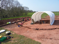
Twyn y Gaer is in northern Gwent and
the excavation was overseen by Alan Probert. See below for interim reports. It
is part of a small group of hillforts commanding the southern approaches to the
Black Mountains. It was excavated largely by volunteers from Abergavenny
Archaeological Group. The disadvantages of hillfort living are obvious as it is
a good climb up from the access lane. They must have conserved their rain water
supplies well as it is several hundred metres of steep descent to the nearest
seeping of water from the side of the hill on the east for regular animal
watering and human supplies. The plan is oval with a single east-facing
in-turned entrance. The interior is divided by two lines of ramparts and
ditches facing east with central entrances to each. It is impressive now with
clearly demarked raised banks and ditches enclosing the summit and must have
been even more so at the time. It has extensive views over the adjoining
countryside, including other hill forts, and students at University Wales
College Newport have looked at the pairing or clusters of hillforts and lines
of sight between them. (GCH, p.156)
The eastern part was built first,
added to by the western subdivision and in the last phase reduced to the
western area. The finds include glass beads, brooches, salt containers, querns,
iron and copper alloy objects and iron working debris, but occupation seemed to
have stopped by the Roman period.
Five small yellow and blue beads from Twyn Y Gaer
 |
| With permission from NMW, St Fagans National Museum of History see link Glass Beads |
Only five of seven of the glass beads
depicted above come from Twyn y Gaer hillfort and they are the small blue and
yellow beads. The large central bead is from Glanbidno Uchaf, Powys, as is one
of the yellow beads. The glass beads from Twyn-y-Gaer are dated from between
the fourth to the first centuries BC and chemical analysis shows that they were
probably made at glass workshops at the Meare Lake Village site in
Somerset. This indicates the importance of social and trading links across
the Severn.
At Twyn y Gaer there was evidence of ceramic sherds of Llanmelin-Lydney and Malverian styles. The excavator believed that changes part way through its use, both structural and artefactual, suggest the site allegiances had altered to be under southern influences with a cultural if not political extension of Silurian power in the district (Probert 1976 p.118). However, Howell and Pollard suggest that although an interesting idea it should be tested by additional field work. (GCH p.152)
At Twyn y Gaer there was evidence of ceramic sherds of Llanmelin-Lydney and Malverian styles. The excavator believed that changes part way through its use, both structural and artefactual, suggest the site allegiances had altered to be under southern influences with a cultural if not political extension of Silurian power in the district (Probert 1976 p.118). However, Howell and Pollard suggest that although an interesting idea it should be tested by additional field work. (GCH p.152)
Ysgyryd Fawr locally known as the Skirrid
The outline clearly shows the landslip on one side, often attributed in folklore to the action of the Devil. It lies on the east side of the Usk on the summit of the hill and is within sight of Coed y Bwnydd. The remains of an enclosure on its summit surround the later medieval remains of St Michael's Chapel (Click also Coflein and scroll down for pictures.) There are no reports of any excavation there.
The outline clearly shows the landslip on one side, often attributed in folklore to the action of the Devil. It lies on the east side of the Usk on the summit of the hill and is within sight of Coed y Bwnydd. The remains of an enclosure on its summit surround the later medieval remains of St Michael's Chapel (Click also Coflein and scroll down for pictures.) There are no reports of any excavation there.
Twyn y Allt
This hillfort is on the Deri part of the Sugar Loaf (Y
Fâl) ridges above Abergavenny. It was recently shown to have a
rectangular enclosure seen on aerial photography through the thinning oak
trees. It has been much damaged by later quarrying for stone, but it is
possible that it was an early Iron Age defended settlement. (See Coflein.)
Smaller defended farmsteads eg Bryngwyn
Bryngwyn is an example of a
smaller defended farmstead. Bryngwyn is 2 kilometres west of
Raglan where a farmstead existed which persisted into the early years of the
Roman occupation. (See Coflein.)
Artefacts
Other signs of conflict appear such
as a decorated bronze linchpin from a chariot found near Raglan and a
strap-hook with Celtic decoration in the Castle Street excavations
(Abergavenny) which would have belonged to a wealthy warrior.
The first Celtic Iron Age chariot burial from in Wales

Although not in Gwent this recent find in Dyfed is so important that it deserves a mention. The original discovery was made in 2008 by Mike Smith, with his metal detector. He found some Iron Age
chariot fittings, a horse brooch and a terret or rein gauge. The finds were found to be in a pit surrounded by evidence of a
circular mound that had once covered them and close to the remains of an Iron
Age promontory fort of which only 3 ramparts remained. On the last day of the preliminary excavation iron
tyres were found indicating it was a chariot burial. Funding was obtained from the National Lottery Heritage Fund
and Dyfed Achaeological Trust, National Museum Wales and excavation began
again in the Spring of 2009. Bronze chariot fittings were found, iron wheels and an iron
sword. The sword was rare as few had been found in Wales. There were no human or
animal remains because the soil was not suitable for preservation. The chariot had been buried intact with its wheels in
position rather than flattened as with some earlier chariot burials in Yorkshire. The burial was close to the entrance of the promontory
fort and so there was a relationship between the fort and the burial. The date
of about the first century AD relates to the period of Roman invasion which was a period of social change and conflict. The decorated metal work was dated to 40-75AD and interestingly the
designs did not follow tribal divisions as there are close similarities with
areas such as East Anglia and Scotland.
Volunteers were used during the excavation and below is the link to one of the volunteer's blog.
Sources
Grateful thanks to Professor Ray Howell and Peter Strong for GCH permission. See Howell and Pollard, ‘The Iron Age
Settlement and Material Culture,’ The Gwent County History Vol. 1. Gwent in Prehistory and Early History. 140-157. (GCH)
Thanks also to National Museum Wales for permission to us the picture of the glass beads.
Walks in Wales/The National Trust https://www.nationaltrust.org.uk/wales-walks
Adrian Babbage 'Excavations at Coed-y-Bwnydd, Bettws Newydd, Bettws Newydd: An Interim Report'. Monmouthshire Antiquary, Vol. II, Part IV, 1968-1969, 205.
Twyn-y-Gaer: an
interim assessment', in Welsh Antiquity (eds. Boon and Lewis),
105-19.
Notes taken form a lecture by NMW's Adam Gwilt on 17/07/2020 by Christabel Hutchings
Notes taken form a lecture by NMW's Adam Gwilt on 17/07/2020 by Christabel Hutchings
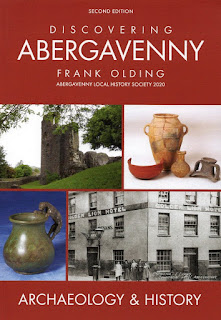
NB: Discovering
Abergavenny: Archaeology and History 2nd Edition by Frank Olding, updated with
new material is now available. Contact hofayz@btinternet.com if you would like a copy.


