Posts

Showing posts from May, 2020

St Illtyd's Church, Mamhilad

Image
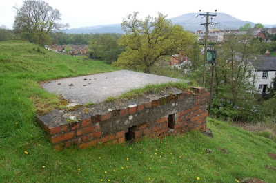
St Illtyd’s Church, Mamhilad The church looking at the south porch The church stands on a slight hill on Old Abergavenny Road off the A4042. Opposite is the Star public house, just a couple of minutes from the Monmouthshire and Brecon Canal. The church showing the south and west porches with the bellcote above the west porch. The latter is used as a vestry. Built in the Perpendicular style, the church comprises a nave, chancel, two porches and a bellcote. It is grade II* listed. The existing features are late medieval, or of the restoration undertaken in 1864–1865 and of the further restoration that took place more recently in 1999–2000. It is still an active church in the parish of Mamhilad with Monkswood with Glascoed. The stile showing the gravestone of Aaron Morris The visit gets interesting the moment you reach the stile entering the churchyard for the stile is the gravestone of Aaron Morris who died 5 May 1680. In 195...

A Visitor to Caerwent in 1786

Image
THE REVD SAMUEL SEYER, A VISITOR TO CAERWENT IN 1786 An antique plan of Venta Silurum or Caerwent’ drawn by Thomas Morrice When the Bristol clergyman and schoolmaster Revd. Samuel Seyer visited Monmouthshire in 1786, he was ‘repeatedly assured’ at Chepstow ‘that there was nothing to see at Caerwent and that it was not even mentioned in the guidebook’. When he got there, he found, ‘a poor miserable village, containing the parish church, one large farmhouse, three alehouses, three shops and about a dozen mean houses within the walls and about half a dozen against the walls outside’. Despite this unpromising start, his account of the Roman town, his sketch map and detailed account of the Roman walls as they then existed, precede Coxe’s better known account and his excellent plan of Caerwent (above) by the surveyor Thomas Morrice by almost twenty years. Seyer saw a Roman mosaic which had been preserved under a protective shed and described Roman roads leading from...

Abergavenny and World War 11.

Image
Abergavenny and World War 11 In 2001-2, a small group of members of the Abergavenny Local History Society (ALHS) trained for in oral history techniques and recorded as many people as they could find who had lived in Abergavenny during WW2. They transcribed extracts from the recordings and produced a book called ‘A Town Remembers: Memories of Wartime Abergavenny 1939 – 1945’ . Copies exist in Abergavenny Library and Gwent Archives. Fortunately, I bought one for myself, too, as it is now out-of-print! Some of the present ALHS Research group were trying to update this knowledge and managed to make three more recordings recently. But memories of that time have faded. Marie was interviewed by David and Barbara Powell and had the clearest memories.   Marie was able to reminisce about her time at school during the early part of the war. She then left to work in the telephone exchange on Frogmore Street, a responsible job as it was easy to overhear information when connecting peo...

Newport's Railway Tunnels

Image
Newport's Railway Tunnels                      Newport : Hillfield tunnels viewed from the south               cc-by-sa/2.0  -©  Jaggery  -  geograph.org.uk/p/1441421           The tunnel on the left opened in 1910. The tunnel on the right opened in 1850. In September 2017 Network Rail published a document entitled ‘Newport Old Tunnel Heritage Impact Statement’. It was in support of the planned works that were going to take place in the tunnels during the electrification of the railway line from London to Cardiff. There are two tunnels which have had various names but in the picture above they are called the Hillfield tunnels. They are also known and the ‘old’ and ‘new’ tunnels. The Grade II listed old tunnel was of concern during electrification but also there were a large number of buildings, 200 fee...